BELGIUM
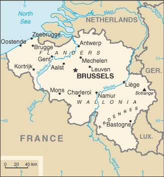
the country of belgium, a kingdom (still) is located between france and netherland~holland, and west of germany. the name "belgium" was created in julius caesar's report "gallic wars" (55 b.c.) the area of belgium was for a long time a central part of the so-called "low countries", which included holland and parts of northern france and western germany. these were ruled by the habsburg empire. in 1830, after the belgian revolution, belgium became an independent country. it consists of the dutch-speaking community (60%), the french speaking community (39%), and a small german-speaking community (1%). until around 1800, the "flanders" region was culturally part of holland.
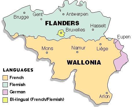
belgiums population is 11.5 mio, the capital city is brussels, a bilingual area.
i have visited belgium many times, from 1971 onwards, especially brussels. at that time all my photography was done to create pictures for voyage albums. of those, just a few got scanned for digital pic's. these are presented in the following gallery.